
Carte topographique Gundagai
Carte interactive
Cliquez sur la carte pour afficher l’altitude.
Gundagai
Gundagai is an inland town with an elevation of 250 metres (820 ft). Almost all of the shire is located in the South West Slopes bio-region and is part of the Riverina agricultural region. The eastern part of the shire is considered part of the South Eastern Highlands bioregion.
À propos de cette carte
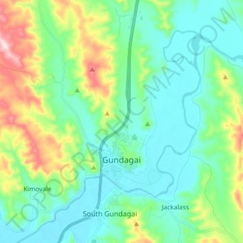
Nom : Carte topographique Gundagai, altitude, relief.
Altitude moyenne : 309 m
Altitude minimum : 208 m
Altitude maximum : 622 m