
Carte topographique Cwm-nant-gwynt
Carte interactive
Cliquez sur la carte pour afficher l’altitude.
À propos de cette carte
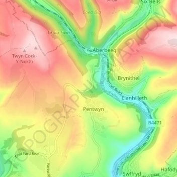
Nom : Carte topographique Cwm-nant-gwynt, altitude, relief.
Altitude moyenne : 270 m
Altitude minimum : 122 m
Altitude maximum : 411 m
Autres cartes topographiques
Cliquez sur une carte pour visualiser sa topographie, son altitude et son relief.
Nant Gwynt
United Kingdom > Wales > Caerphilly > Pentwyn > Cwm-nant-gwynt
Nant Gwynt, Cwm-nant-gwynt, Pentwyn, Crumlin, Caerphilly, Wales, NP13 2DQ, United Kingdom
Altitude moyenne : 261 m