
Carte topographique Lehenagh More
Carte interactive
Cliquez sur la carte pour afficher l’altitude.
À propos de cette carte
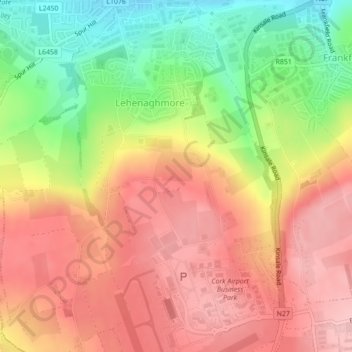
Nom : Carte topographique Lehenagh More, altitude, relief.
Altitude moyenne : 107 m
Altitude minimum : 15 m
Altitude maximum : 173 m
Autres cartes topographiques
Cliquez sur une carte pour visualiser sa topographie, son altitude et son relief.
Douglas
Ireland > Ballincollig - Carrigaline
Douglas, Ballincollig - Carrigaline, Cork City 2019, County Cork, Munster, Ireland
Altitude moyenne : 34 m