Géolocaliser

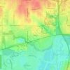
Carte topographique Magnolia Micro Park

Cliquez sur la carte pour afficher l’altitude.

À propos de cette carte

Nom : Carte topographique Magnolia Micro Park, altitude, relief.

Lieu : Magnolia Micro Park, Fort Worth, Tarrant County, Texas, United States (32.73075 -97.33761 32.73094 -97.33722)

Altitude moyenne : 195 m

Altitude minimum : 162 m

Altitude maximum : 215 m

Autres cartes topographiques

Cliquez sur une carte pour visualiser sa topographie, son altitude et son relief.
Melody Hills

United States > Texas > Tarrant County > Fort Worth

Altitude moyenne : 191 m

Tarrant

United States > Texas > Tarrant County > Fort Worth

Altitude moyenne : 155 m

Fort Worth

United States > Texas > Tarrant County > Fort Worth

Altitude moyenne : 202 m

Rendon

United States > Texas > Tarrant County > Fort Worth

Altitude moyenne : 221 m

Benbrook Lake

United States > Texas > Tarrant County > Fort Worth

Construction of Benbrook dam began in May 1947, and was practically completed when floodgates were closed and deliberate impoundment was begun in September 1952. The cost to build the lake was $14.5 million ($112 million in 2007 dollars). The rolled-earth embankment is 9,130 feet (2,783 m) in length, including…

Altitude moyenne : 230 m

Équipez-vous pour votre prochaine aventure :

🚴Compteur vélo avec cartographie - Suivez vos performances et votre itinéraire sur les routes de Suisse
🔦Lampes frontales - Éclairage mains libres pour randonnée et bivouac
👖Pantalons de randonnée - Résistants et respirants
🔥Réchaud de camping compact - Préparez vos repas chauds partout, même par vent fort
🧤Gants de montagne tactiles - Gardez vos mains au chaud tout en manipulant votre GPS ou smartphone

En tant que Partenaire Amazon, ce site perçoit une commission sur les achats éligibles sans surcoût pour vous.