
Carte topographique Bethel Park
Carte interactive
Cliquez sur la carte pour afficher l’altitude.
À propos de cette carte
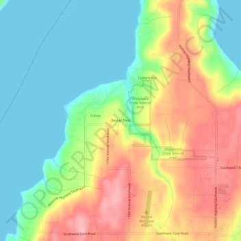
Nom : Carte topographique Bethel Park, altitude, relief.
Altitude moyenne : 58 m
Altitude minimum : 0 m
Altitude maximum : 142 m
Autres cartes topographiques
Cliquez sur une carte pour visualiser sa topographie, son altitude et son relief.
Vashon Island
United States > Washington > King County > Vashon
Vashon Island, Vashon, King County, Washington, 98070, United States
Altitude moyenne : 46 m