
Carte topographique Craig's Crest
Carte interactive
Cliquez sur la carte pour afficher l’altitude.
À propos de cette carte
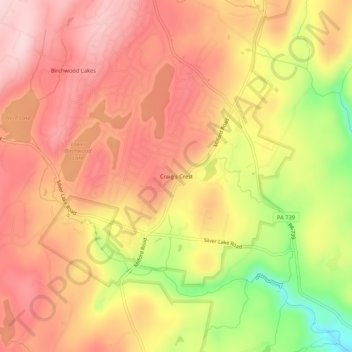
Nom : Carte topographique Craig's Crest, altitude, relief.
Altitude moyenne : 290 m
Altitude minimum : 138 m
Altitude maximum : 376 m
Autres cartes topographiques
Cliquez sur une carte pour visualiser sa topographie, son altitude et son relief.
Dingmans Ferry
United States > Pennsylvania > Pike County > Delaware Township
Dingmans Ferry, Delaware Township, Pike County, Pennsylvania, 07851, United States
Altitude moyenne : 192 m