Géolocaliser

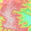
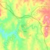
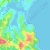
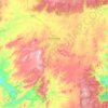
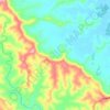
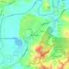
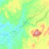
Carte topographique Little Murray

Cliquez sur la carte pour afficher l’altitude.

À propos de cette carte

Nom : Carte topographique Little Murray, altitude, relief.

Lieu : Little Murray, Bellingen Shire Council, New South Wales, Australia (-30.39993 152.53873 -30.39983 152.53883)

Altitude moyenne : 1’094 m

Altitude minimum : 552 m

Altitude maximum : 1’365 m

Autres cartes topographiques

Cliquez sur une carte pour visualiser sa topographie, son altitude et son relief.
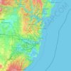
Sydney

Australia > New South Wales

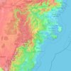
Sydney's topography is characterized by a diverse landscape that seamlessly blends coastal features with inland plateaus. The city is divided into two primary regions: the relatively flat Cumberland Plain to the south and west of Sydney Harbour, and the elevated Hornsby Plateau to the north. The Cumberland…

Altitude moyenne : 51 m
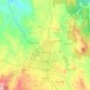
Orange

Australia > New South Wales

Orange is a city in the Central Tablelands region of New South Wales, Australia. It is 254 km (158 mi) west of the state capital, Sydney [206 km (128 mi) on a great circle], at an altitude of 862 metres (2,828 ft). Orange had an estimated urban population of 40,493 as of June 2018 making the city a significant…

Altitude moyenne : 852 m
Newcastle

Australia > New South Wales > Newcastle

Altitude moyenne : 5 m

Port Macquarie

Australia > New South Wales

Altitude moyenne : 5 m

Cooma

Australia > New South Wales

Altitude moyenne : 869 m

Penrith

Australia > New South Wales > Sydney > Penrith

Penrith is a city in New South Wales, Australia, located in Greater Western Sydney, 55 kilometres (31 mi) west of the Sydney central business district on the banks of the Nepean River, on the outskirts of the Cumberland Plain. Its elevation is 32 metres (105 ft).

Altitude moyenne : 34 m
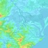
Barrington Tops

Australia > New South Wales

Altitude moyenne : 1’107 m

Wauchope

Australia > New South Wales

Altitude moyenne : 32 m

Delegate

Australia > New South Wales

Altitude moyenne : 841 m

Randwick

Australia > New South Wales > Sydney

Altitude moyenne : 44 m

Carrington

Australia > New South Wales > Newcastle

Altitude moyenne : 3 m

Goulburn

Australia > New South Wales

Owing to its elevation, Goulburn has an oceanic climate (Cfb) with warm summers and cool winters; with a high diurnal range. Its climate is variable much of the year, though generally dry with maximum temperatures ranging from 11.8 °C (53.2 °F) in July to 28.3 °C (82.9 °F) in January. Rainfall is…

Altitude moyenne : 666 m
Raymond Terrace

Australia > New South Wales

Altitude moyenne : 9 m

Bondi Beach

Australia > New South Wales > Sydney

Altitude moyenne : 31 m

Yass

Australia > New South Wales

Yass is located 280 km south-west of Sydney, on the Hume Highway. The Yass River, which is a tributary of the Murrumbidgee River, flows through the town. Yass is 59 km from Canberra; lying at an elevation of 505 m AMSL.

Altitude moyenne : 533 m
Byron Bay

Australia > New South Wales

Byron Bay, located in northeastern New South Wales, Australia, is characterized by diverse topography shaped by its geological history. The town is part of the erosion caldera of the ancient Tweed Volcano, which erupted approximately 23 million years ago, resulting in the rich volcanic soils that define the…

Altitude moyenne : 7 m
King Creek

Australia > New South Wales > Wauchope > King Creek

Altitude moyenne : 6 m

North Sydney

Australia > New South Wales > Sydney

Altitude moyenne : 50 m

Castle Hill

Australia > New South Wales

Altitude moyenne : 123 m

Wolli Creek

Australia > New South Wales > Sydney

Altitude moyenne : 27 m

Glen Innes

Australia > New South Wales

Altitude moyenne : 1’083 m

Avoca Beach

Australia > New South Wales

Altitude moyenne : 23 m

Umina Beach

Australia > New South Wales

Altitude moyenne : 38 m

Wollongbar

Australia > New South Wales

Altitude moyenne : 134 m

Emu Plains

Australia > New South Wales > Penrith

Altitude moyenne : 27 m

Lismore

Australia > New South Wales

Altitude moyenne : 23 m

Belmont

Australia > New South Wales

Altitude moyenne : 14 m

Tenterfield

Australia > New South Wales

Altitude moyenne : 891 m

Mandurama

Australia > New South Wales

Altitude moyenne : 742 m

Curramore

Australia > New South Wales

Altitude moyenne : 143 m

Kanwal

Australia > New South Wales

Altitude moyenne : 23 m

Shoalhaven Heads

Australia > New South Wales

Altitude moyenne : 5 m

Northmead

Australia > New South Wales

Altitude moyenne : 52 m

Mittagong

Australia > New South Wales

Altitude moyenne : 672 m

Goonellabah

Australia > New South Wales

Altitude moyenne : 86 m

Bangalow

Australia > New South Wales

Altitude moyenne : 83 m

Lake Cathie

Australia > New South Wales

Altitude moyenne : 6 m

Bundeena

Australia > New South Wales

Altitude moyenne : 20 m

Marrickville

Australia > New South Wales > Sydney

Altitude moyenne : 17 m

Bywong

Australia > New South Wales

Altitude moyenne : 734 m

Shoal Bay

Australia > New South Wales

Altitude moyenne : 16 m

Glen Davis

Australia > New South Wales

Altitude moyenne : 619 m

Malua Bay

Australia > New South Wales

Altitude moyenne : 22 m

Dunedoo

Australia > New South Wales

Altitude moyenne : 467 m

Woombah

Australia > New South Wales

Altitude moyenne : 14 m

Leeton

Australia > New South Wales

Altitude moyenne : 156 m

Coorabell

Australia > New South Wales

Altitude moyenne : 70 m

Noorumba Reserve

Australia > New South Wales > Sydney

Altitude moyenne : 147 m

Nulkaba

Australia > New South Wales

Altitude moyenne : 78 m

Parramatta

Australia > New South Wales

Altitude moyenne : 22 m

Sydney

Australia > New South Wales

Sydney's topography is characterized by a diverse landscape that seamlessly blends coastal features with inland plateaus. The city is divided into two primary regions: the relatively flat Cumberland Plain to the south and west of Sydney Harbour, and the elevated Hornsby Plateau to the north. The Cumberland…

Altitude moyenne : 51 m

Blackheath

Australia > New South Wales

Blackheath (postcode: 2785) is an Australian town located near the highest point of the Blue Mountains, between Katoomba and Mount Victoria in New South Wales. The town's altitude is about 1,065 metres (3,494 ft) AHD  and it is located about 120 kilometres (75 mi) west north-west of Sydney, 11 kilometres…

Altitude moyenne : 893 m

Burringbar

Australia > New South Wales

Altitude moyenne : 81 m

Salisbury

Australia > New South Wales

Altitude moyenne : 555 m

Sunny Corner

Australia > New South Wales

Altitude moyenne : 1’119 m

Yerong Creek

Australia > New South Wales

Altitude moyenne : 246 m

Oakville

Australia > New South Wales > Sydney

Altitude moyenne : 32 m

Mount Tomah

Australia > New South Wales

Altitude moyenne : 720 m

Bagotville

Australia > New South Wales

Altitude moyenne : 14 m

Moruya

Australia > New South Wales

Altitude moyenne : 37 m

Cooranbong

Australia > New South Wales

Altitude moyenne : 72 m

Galston

Australia > New South Wales > Sydney

Altitude moyenne : 167 m

Katoomba

Australia > New South Wales

Altitude moyenne : 904 m

Heathcote

Australia > New South Wales > Sydney

Altitude moyenne : 148 m

Norah Head

Australia > New South Wales

Altitude moyenne : 9 m

Cronulla

Australia > New South Wales > Sydney

Altitude moyenne : 8 m

Pitt Town

Australia > New South Wales > Sydney

Altitude moyenne : 19 m

Sydney

Australia > New South Wales > Sydney

Altitude moyenne : 23 m

Tantangara Reservoir

Australia > New South Wales

Altitude moyenne : 1’276 m

Guildford

Australia > New South Wales

Altitude moyenne : 28 m

Morton National Park

Australia > New South Wales

Altitude moyenne : 427 m

Mangrove Creek

Australia > New South Wales

Altitude moyenne : 144 m

Carcoar

Australia > New South Wales

Altitude moyenne : 818 m

Crowdy Head

Australia > New South Wales

Altitude moyenne : 1 m

Cowra

Australia > New South Wales

Altitude moyenne : 379 m

Georges River

Australia > New South Wales

Altitude moyenne : 120 m

Glenreagh

Australia > New South Wales

Altitude moyenne : 178 m

Mount View

Australia > New South Wales > Cessnock

Altitude moyenne : 188 m

Lake Conjola

Australia > New South Wales

Altitude moyenne : 19 m

Blaxland

Australia > New South Wales

Altitude moyenne : 214 m

Emmaville

Australia > New South Wales

Emmaville is at an elevation of 890 metres AHD. At the 2006 census, the Emmaville "urban centre/locality" had a population of 247 (in the 2001 census it was 303) and there were 535 persons usually resident in the Emmaville region.

Altitude moyenne : 859 m

Ocean Shores

Australia > New South Wales

Altitude moyenne : 12 m

Gulmarrad

Australia > New South Wales

Altitude moyenne : 10 m

Gorokan

Australia > New South Wales

Altitude moyenne : 7 m

Gerringong

Australia > New South Wales

Altitude moyenne : 37 m

Ilford

Australia > New South Wales

Altitude moyenne : 834 m
Équipez-vous pour votre prochaine aventure :

🧤Sous-gants en soie - Apport de chaleur naturelle sans épaisseur supplémentaire
🔋Chargeur Solaire Portatif - Autonomie énergétique pour vos longues randonnées en autonomie
🥾Chaussures de marche Femme - Confort et adhérence pour explorer les reliefs jurassiens et alpins
🏔️Équipement de montagne - Préparation complète outdoor
⛺Piquets de tente légers - Solidité et légèreté pour remplacer vos piquets d'origine

En tant que Partenaire Amazon, ce site perçoit une commission sur les achats éligibles sans surcoût pour vous.