
Carte topographique Gerlach
Carte interactive
Cliquez sur la carte pour afficher l’altitude.
Gerlach
According to the United States Census Bureau, the Gerlach CDP has a total area of 3.1 square miles (8.0 km2), all land. Its elevation is 3,944 ft (1,202 m). Gerlach is approximately 100 miles (160 km) north of Reno, Nevada.
À propos de cette carte
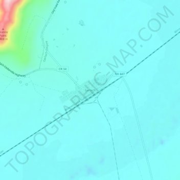
Nom : Carte topographique Gerlach, altitude, relief.
Lieu : Gerlach, Washoe County, Nevada, 89412, United States (40.63181 -119.37626 40.67181 -119.33626)
Altitude moyenne : 1’208 m
Altitude minimum : 1’171 m
Altitude maximum : 1’510 m