
Carte topographique Alturas
Carte interactive
Cliquez sur la carte pour afficher l’altitude.
À propos de cette carte
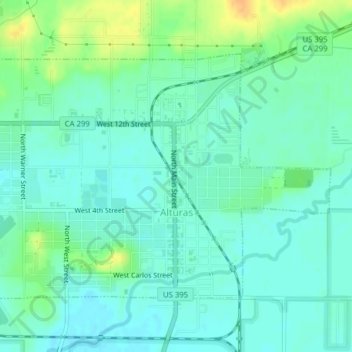
Nom : Carte topographique Alturas, altitude, relief.
Altitude moyenne : 1’337 m
Altitude minimum : 1’327 m
Altitude maximum : 1’358 m
Alturas is located on the Pit River, east of the center of Modoc County, at an elevation of 4370 feet (1332 m). As the county seat, the town is a home to regional government offices, including a California Highway Patrol office and a state Department of Motor Vehicles office.