
Carte topographique Workum
Carte interactive
Cliquez sur la carte pour afficher l’altitude.
À propos de cette carte
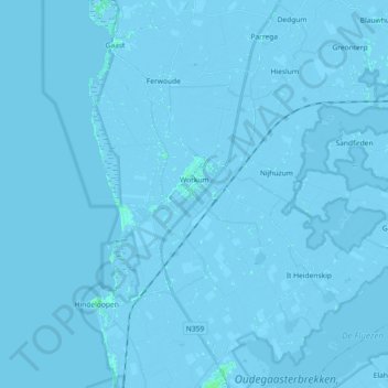
Nom : Carte topographique Workum, altitude, relief.
Lieu : Workum, Súdwest-Fryslân, Frisia, Netherlands (52.93484 5.29796 53.01255 5.48009)
Altitude moyenne : -1 m
Altitude minimum : -6 m
Altitude maximum : 5 m
Autres cartes topographiques
Cliquez sur une carte pour visualiser sa topographie, son altitude et son relief.
Leeuwarden
Netherlands > Frisia > Leeuwarden
Leeuwarden, Frisia, Netherlands, 8911BR, Netherlands
Altitude moyenne : 0 m
Wolvega
Netherlands > Frisia > Wolvega > Wolvega
Wolvega, Weststellingwerf, Frisia, Netherlands, 8471JA, Netherlands
Altitude moyenne : 1 m
Schiermonnikoog
Netherlands > Frisia > Schiermonnikoog
Schiermonnikoog, Frisia, Netherlands
Altitude moyenne : 0 m
De Marne
Netherlands > Frisia > Schettens > Viersprong
De Marne, Viersprong, Schettens, Súdwest-Fryslân, Frisia, Netherlands, 8744 ES, Netherlands
Altitude moyenne : -1 m
Sneek
Netherlands > Frisia > Sneek > Sneek
Sneek, Súdwest-Fryslân, Frisia, Netherlands, 8601CL, Netherlands
Altitude moyenne : 0 m
Bolsward
Netherlands > Frisia > Bolsward > Bolsward
Bolsward, Súdwest-Fryslân, Frisia, Netherlands, 8701HZ, Netherlands
Altitude moyenne : -1 m