
Carte topographique Richmondshire
Carte interactive
Cliquez sur la carte pour afficher l’altitude.
À propos de cette carte
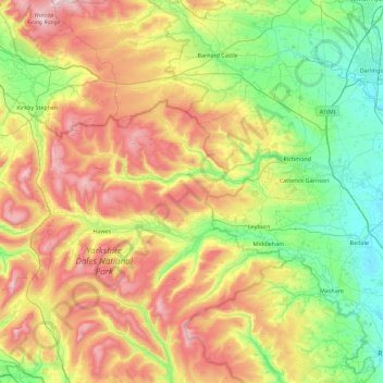
Nom : Carte topographique Richmondshire, altitude, relief.
Altitude moyenne : 301 m
Altitude minimum : 27 m
Altitude maximum : 786 m
Autres cartes topographiques
Cliquez sur une carte pour visualiser sa topographie, son altitude et son relief.
Großbritannien
Vereinigtes Königreich > England > Richmondshire
Großbritannien, Richmondshire, North Yorkshire, Yorkshire and the Humber, England, Vereinigtes Königreich
Altitude moyenne : 52 m