
Carte topographique Mulaló
Carte interactive
Cliquez sur la carte pour afficher l’altitude.
À propos de cette carte
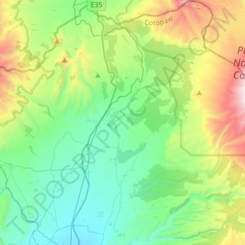
Nom : Carte topographique Mulaló, altitude, relief.
Lieu : Mulaló, Latacunga, Cotopaxi, Ecuador (-0.83377 -78.62311 -0.59284 -78.38093)
Altitude moyenne : 3’430 m
Altitude minimum : 2’879 m
Altitude maximum : 4’898 m
Autres cartes topographiques
Cliquez sur une carte pour visualiser sa topographie, son altitude et son relief.