
Carte topographique Big Bear Lake
Carte interactive
Cliquez sur la carte pour afficher l’altitude.
À propos de cette carte
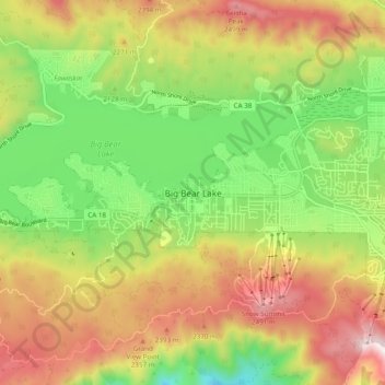
Nom : Carte topographique Big Bear Lake, altitude, relief.
Altitude moyenne : 2’184 m
Altitude minimum : 1’839 m
Altitude maximum : 2’586 m
Since 1970, Big Bear Lake has held its annual Oktoberfest. The Big Bear Lake Oktoberfest also sports the highest beer garden, by elevation, in the United States. Big Bear Lake was incorporated as a city on November 28, 1980.