
Carte topographique Lake Coeur d'Alene
Carte interactive
Cliquez sur la carte pour afficher l’altitude.
À propos de cette carte
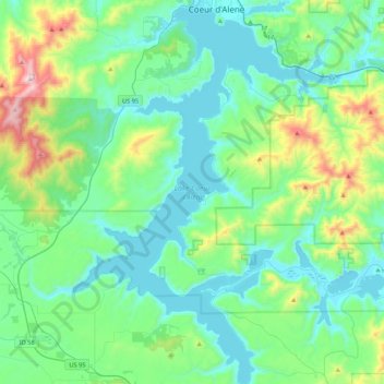
Nom : Carte topographique Lake Coeur d'Alene, altitude, relief.
Altitude moyenne : 827 m
Altitude minimum : 640 m
Altitude maximum : 1’579 m
The lake's elevation varies from 2,128 feet (649 m) above sea level in the summer to up to 7 feet (2.1 m) lower in the winter, controlled by the Post Falls Dam 9 miles (14 km) below the lake on the Spokane River.