
Carte topographique Marley Green
Cliquez sur la carte pour afficher l’altitude.
À propos de cette carte
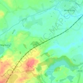
Nom : Carte topographique Marley Green, altitude, relief.
Altitude moyenne : 81 m
Altitude minimum : 62 m
Altitude maximum : 124 m
Autres cartes topographiques
Cliquez sur une carte pour visualiser sa topographie, son altitude et son relief.
Alderley Edge
United Kingdom > England > Cheshire East
Alderley Edge is 6 miles (10 km) northwest of Macclesfield and 12 miles (19 km) south of Manchester, at the base of a steep and thickly wooded sandstone escarpment, Alderley Edge, which is the area's chief topographical feature and overlooks the Cheshire Plain.
Altitude moyenne : 91 m
Peckforton Moss
United Kingdom > England > Cheshire East > Bulkeley > Peckforton
Altitude moyenne : 100 m
Mottram St. Andrew
United Kingdom > England > Cheshire East > Mottram St Andrew
Altitude moyenne : 105 m