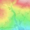
Carte topographique Middleham
Cliquez sur la carte pour afficher l’altitude.
Middleham
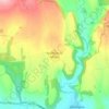
The town lies between 400 and 500 feet (120 and 150 m) above ordnance datum. The valley of the River Ure below the town has an altitude of 325 feet (99 m) and the summit of the hill to the south-west of the town of 850 feet (260 m). The parish contains 2,155 acres (872 ha) of land, mostly permanent pasture with about 150 acres (61 ha) arable. The topsoil is mixed. The valley has modern alluvial terraces and gravel deposits, but the subsoil is mainly limestone, intersected here and there by sandstone with plate. There is a known vein of lead in the northern part of the parish. Braithwaite lead mine lies just outside the parish borders.
À propos de cette carte

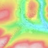
Nom : Carte topographique Middleham, altitude, relief.
Altitude moyenne : 157 m
Altitude minimum : 95 m
Altitude maximum : 378 m
Autres cartes topographiques
Cliquez sur une carte pour visualiser sa topographie, son altitude et son relief.
Harrogate
United Kingdom > England > North Yorkshire
Harrogate is situated on the edge of the Yorkshire Dales, with the Vale of York to the east and the upland Yorkshire Dales to the west and north-west. It has a dry and mild climate, typical of places in the rain shadow of the Pennines. It is on the A59 from Skipton to York. At an altitude of between 100 and…
Altitude moyenne : 106 m














Bolton Castle
United Kingdom > England > North Yorkshire > Redmire > Castle Bolton
Altitude moyenne : 250 m


Thimbleby & Osmotherly Show field
United Kingdom > England > North Yorkshire > Thimbleby
Altitude moyenne : 152 m






Killinghall
United Kingdom > England > North Yorkshire > Harrogate > Killinghall
Altitude moyenne : 86 m



Ribblesdale
United Kingdom > England > North Yorkshire > Horton in Ribblesdale
Altitude moyenne : 368 m

Willerby Brow Plantation
United Kingdom > England > North Yorkshire > Ryedale > Staxton > Binnington
Altitude moyenne : 100 m

Howgill
United Kingdom > England > North Yorkshire > Craven > Appletreewick > Howgill
Altitude moyenne : 257 m