
Carte topographique Harris Neck National Wildlife Refuge
Carte interactive
Cliquez sur la carte pour afficher l’altitude.
À propos de cette carte
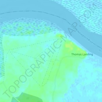
Nom : Carte topographique Harris Neck National Wildlife Refuge, altitude, relief.
Altitude moyenne : 3 m
Altitude minimum : -3 m
Altitude maximum : 13 m
Autres cartes topographiques
Cliquez sur une carte pour visualiser sa topographie, son altitude et son relief.
Black Island
United States > Georgia > McIntosh County
Black Island, McIntosh County, Georgia, United States
Altitude moyenne : 2 m
Darien
United States > Georgia > McIntosh County
Darien, McIntosh County, Georgia, 31305, United States
Altitude moyenne : 3 m
Blackbeard Island
United States > Georgia > McIntosh County
Blackbeard Island, McIntosh County, Georgia, United States
Altitude moyenne : 2 m
Pico Island
United States > Georgia > McIntosh County > Darien
Pico Island, Darien, McIntosh County, Georgia, 31305, United States
Altitude moyenne : 4 m