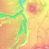
Carte topographique Suttle Lake
Cliquez sur la carte pour afficher l’altitude.
Suttle Lake
Suttle Lake is located near the crest of the Cascade Mountains in western Jefferson County, Oregon. Its elevation is 3,438 feet (1,048 m) above sea level. The lake is surrounded by the Deschutes National Forest. The lake is 13 miles (21 km) west of Sisters, Oregon and 90 miles (140 km) east of Salem, in the Willamette Valley. Highway 20 runs along the north side of the lake as is climbs a ridge toward Santiam Pass, 5 miles (8.0 km) west of the lake.
À propos de cette carte

Nom : Carte topographique Suttle Lake, altitude, relief.
Lieu : Suttle Lake, Jefferson County, Oregon, United States (44.41628 -121.75602 44.42765 -121.72668)
Altitude moyenne : 1’119 m
Altitude minimum : 1’026 m
Altitude maximum : 1’293 m
Autres cartes topographiques
Cliquez sur une carte pour visualiser sa topographie, son altitude et son relief.