
Carte topographique Villa La Angostura
Carte interactive
Cliquez sur la carte pour afficher l’altitude.
À propos de cette carte
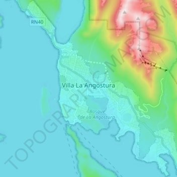
Nom : Carte topographique Villa La Angostura, altitude, relief.
Altitude moyenne : 921 m
Altitude minimum : 759 m
Altitude maximum : 1’824 m
The elevation of the city centre is about 790 m, the lake is at 765 m. Surrounding mountains range from 1,500 m to about 2,000 m (Cerro Bayo, right behind the city, is 1,782 m high).