
Carte topographique Parrish
Cliquez sur la carte pour afficher l’altitude.
Parrish
Parrish features a predominantly flat terrain with an average elevation of approximately 36 feet above sea level. The area's landscape is characterized by gently rolling hills and low-lying regions, making it typical of the Central Florida topography. Surrounding Parrish are numerous wetlands and drainage canals, which play a vital role in managing water flow and supporting local ecosystems. This low elevation renders the area susceptible to flooding, especially during heavy rainfall or storm surges, and necessitates careful urban planning to mitigate potential impacts from rising sea levels.
À propos de cette carte
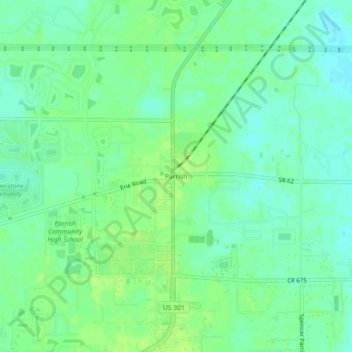
Nom : Carte topographique Parrish, altitude, relief.
Lieu : Parrish, Manatee County, Florida, 34219, United States (27.56754 -82.44509 27.60754 -82.40509)
Altitude moyenne : 12 m
Altitude minimum : 5 m
Altitude maximum : 17 m
Autres cartes topographiques
Cliquez sur une carte pour visualiser sa topographie, son altitude et son relief.
Bradenton
United States > Florida > Manatee County
Bradenton features a predominantly flat and gently undulating terrain typical of the region. The city is situated near the confluence of the Manatee River, which meanders through the area and flows into the Gulf of Mexico, creating a series of lush riverbanks and estuaries that support diverse ecosystems.…
Altitude moyenne : 5 m
Anna Maria island
United States > Florida > Manatee County
Anna Maria Island features a flat, sandy topography typical of a barrier island on the Gulf Coast. With an average elevation of around 15 feet above sea level, the terrain includes broad beaches, low dunes, and narrow stretches of sandy soil, making it highly vulnerable to storm surges and tidal flooding. The…
Altitude moyenne : 2 m
West Samoset
United States > Florida > Manatee County > South Bradenton > West Samoset
Altitude moyenne : 11 m
Bradenton
United States > Florida > Manatee County
Bradenton was affected by World War II like many other cities in Florida and the United States. During the war, Manatee County had its own Civil Defense battalion in it with two subunits existing in Bradenton and another for nearby Manatee. A recreational center was opened in March 1942 at a building on the…
Altitude moyenne : 5 m
Bradenton
United States > Florida > Manatee County
Bradenton would be affected by World War II like many other cities in Florida and the United States. During the war, Manatee County would have its own Civil Defense battalion in it with two subunits existing in Bradenton and another for nearby Manatee. A recreational center would be opened in March 1942 at a…
Altitude moyenne : 5 m