Géolocaliser

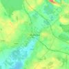
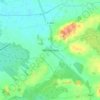
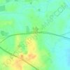
Carte topographique Hiskinstown

Cliquez sur la carte pour afficher l’altitude.

À propos de cette carte

Nom : Carte topographique Hiskinstown, altitude, relief.

Lieu : Hiskinstown, Killulagh ED, The Municipal District of Mullingar — Kinnegad, County Westmeath, Leinster, Ireland (53.57353 -7.15048 53.59018 -7.12612)

Altitude moyenne : 85 m

Altitude minimum : 74 m

Altitude maximum : 100 m

Autres cartes topographiques

Cliquez sur une carte pour visualiser sa topographie, son altitude et son relief.
Athlone

Ireland > County Westmeath > Athlone

Altitude moyenne : 44 m

Hill of Uisneach

Ireland > County Westmeath

Altitude moyenne : 128 m

Mullingar

Ireland > County Westmeath

Altitude moyenne : 101 m

Castletown

Ireland > County Westmeath

Altitude moyenne : 88 m

Rathwire

Ireland > County Westmeath

Altitude moyenne : 94 m

Loughanavally

Ireland > County Westmeath

Altitude moyenne : 130 m

Bunbrosna

Ireland > County Westmeath

Altitude moyenne : 97 m

Ballinahown

Ireland > County Westmeath

Altitude moyenne : 49 m

Hill of Uisneach

Ireland > County Westmeath

Altitude moyenne : 128 m

Multyfarnham

Ireland > County Westmeath > Multyfarnham

Altitude moyenne : 88 m

Ballinea

Ireland > County Westmeath > Ballinea

Altitude moyenne : 100 m

Killucan

Ireland > County Westmeath > Killucan

Altitude moyenne : 97 m

Mullingar

Ireland > County Westmeath

Altitude moyenne : 99 m

Lough Bane

Ireland > County Westmeath

Altitude moyenne : 66 m

Streamstown

Ireland > County Westmeath

Altitude moyenne : 105 m

Fore

Ireland > County Westmeath

Altitude moyenne : 110 m

Lough Sheever

Ireland > County Westmeath

Altitude moyenne : 98 m

Ballykeeran

Ireland > County Westmeath

Altitude moyenne : 47 m

Nure Bog

Ireland > County Westmeath

Altitude moyenne : 85 m

Correllstown

Ireland > County Westmeath

Altitude moyenne : 93 m

River Brosna

Ireland > County Westmeath > Mullingar

Altitude moyenne : 100 m

Dungolman River

Ireland > County Westmeath

Altitude moyenne : 58 m

Footy's Hill

Ireland > County Westmeath

Altitude moyenne : 95 m

Rathowen

Ireland > County Westmeath

Altitude moyenne : 71 m

Équipez-vous pour votre prochaine aventure :

🥾Chaussures de marche Homme - Maintien et imperméabilité pour les sentiers techniques suisses
🧢Bonnets en laine mérinos - Chaleur naturelle
🎿Housse de transport skis - Protégez votre matériel lors de vos déplacements en train ou voiture
🗺️Cartes topographiques papier - Cartes détaillées pour randonnée, orientation et lecture du relief
🧗Sets de via ferrata - Sécurité sur parcours équipés

En tant que Partenaire Amazon, ce site perçoit une commission sur les achats éligibles sans surcoût pour vous.