
Carte topographique Fulshear
Cliquez sur la carte pour afficher l’altitude.
À propos de cette carte
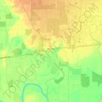
Nom : Carte topographique Fulshear, altitude, relief.
Lieu : Fulshear, Fort Bend County, Texas, United States (29.64406 -95.91222 29.73258 -95.84597)
Altitude moyenne : 37 m
Altitude minimum : 18 m
Altitude maximum : 48 m
Autres cartes topographiques
Cliquez sur une carte pour visualiser sa topographie, son altitude et son relief.
Brazos Bend State Park
United States > Texas > Fort Bend County > Alvin
Brazos Bend State Park occupies land bordering the Brazos River and includes within its boundaries low-lying areas left over from the River's previous meanderings. Pre-Columbian inhabitants included a series of Native American groups, most notably the Karankawa. The land passed through a variety of landowners'…
Altitude moyenne : 17 m
Sienna (Brazos River) Park
United States > Texas > Fort Bend County > Missouri City
Altitude moyenne : 20 m