Géolocaliser

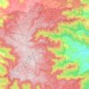
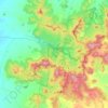
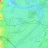
Carte topographique Hexam Vale

Cliquez sur la carte pour afficher l’altitude.

À propos de cette carte

Nom : Carte topographique Hexam Vale, altitude, relief.

Lieu : Hexam Vale, Upper Hunter Shire Council, New South Wales, 2337, Australia (-31.94025 151.08900 -31.94015 151.08910)

Altitude moyenne : 549 m

Altitude minimum : 403 m

Altitude maximum : 742 m

Autres cartes topographiques

Cliquez sur une carte pour visualiser sa topographie, son altitude et son relief.
Sydney

Australia > New South Wales

Sydney's topography is characterized by a diverse landscape that seamlessly blends coastal features with inland plateaus. The city is divided into two primary regions: the relatively flat Cumberland Plain to the south and west of Sydney Harbour, and the elevated Hornsby Plateau to the north. The Cumberland…

Altitude moyenne : 51 m
Central Coast Council

Australia > New South Wales

Altitude moyenne : 103 m

Penrith

Australia > New South Wales > Sydney > Penrith

Penrith is a city in New South Wales, Australia, located in Greater Western Sydney, 55 kilometres (31 mi) west of the Sydney central business district on the banks of the Nepean River, on the outskirts of the Cumberland Plain. Its elevation is 32 metres (105 ft).

Altitude moyenne : 34 m
Katoomba

Australia > New South Wales

Altitude moyenne : 904 m

Newcastle

Australia > New South Wales > Newcastle

Altitude moyenne : 5 m

Sydney

Australia > New South Wales > Sydney

Altitude moyenne : 23 m

Armidale

Australia > New South Wales

Altitude moyenne : 1’036 m

Kenthurst

Australia > New South Wales > Sydney

Altitude moyenne : 100 m

Possum Creek

Australia > New South Wales

Altitude moyenne : 78 m

Bar Point

Australia > New South Wales

Altitude moyenne : 76 m

Campbelltown

Australia > New South Wales

Altitude moyenne : 96 m

Parramatta

Australia > New South Wales

Altitude moyenne : 22 m

Glen Innes

Australia > New South Wales

Altitude moyenne : 1’083 m

Inner West

Australia > New South Wales > Sydney

Altitude moyenne : 19 m

Barrington Tops

Australia > New South Wales

Altitude moyenne : 1’107 m

Annandale

Australia > New South Wales > Sydney

Altitude moyenne : 24 m

Tocumwal

Australia > New South Wales

Altitude moyenne : 112 m

Tweed Shire Council

Australia > New South Wales

Altitude moyenne : 212 m

Orange

Australia > New South Wales

Orange is a city in the Central Tablelands region of New South Wales, Australia. It is 254 km (158 mi) west of the state capital, Sydney [206 km (128 mi) on a great circle], at an altitude of 862 metres (2,828 ft). Orange had an estimated urban population of 40,493 as of June 2018 making the city a significant…

Altitude moyenne : 852 m
Castle Hill

Australia > New South Wales

Altitude moyenne : 123 m

Tumut

Australia > New South Wales

Altitude moyenne : 355 m

Fairlight

Australia > New South Wales > Sydney

Altitude moyenne : 23 m

Blue Mountains

Australia > New South Wales

A sandstone plateau dominated by a landscape of endless eucalyptus forests, the Blue Mountains are located at the top of a 470-million-year-old quartzite. In the Permian period, a shallow sea covered the region, when rivers brought shales, siltstones and mudstones. Then during the Mesozoic period, rivers…

Altitude moyenne : 566 m

Deniliquin

Australia > New South Wales

Altitude moyenne : 94 m

Byron Bay

Australia > New South Wales

Byron Bay, located in northeastern New South Wales, Australia, is characterized by diverse topography shaped by its geological history. The town is part of the erosion caldera of the ancient Tweed Volcano, which erupted approximately 23 million years ago, resulting in the rich volcanic soils that define the…

Altitude moyenne : 7 m
Wahroonga

Australia > New South Wales

Altitude moyenne : 159 m

Terrigal

Australia > New South Wales

Altitude moyenne : 13 m

Nowra

Australia > New South Wales

Altitude moyenne : 21 m

Granville

Australia > New South Wales

Altitude moyenne : 17 m

Bega

Australia > New South Wales

Altitude moyenne : 44 m

Ocean Shores

Australia > New South Wales

Altitude moyenne : 12 m

Banora Point

Australia > New South Wales

Altitude moyenne : 17 m

Hawkesbury River

Australia > New South Wales

Altitude moyenne : 130 m

Coraki

Australia > New South Wales

Altitude moyenne : 6 m

Braidwood

Australia > New South Wales

Altitude moyenne : 674 m

Chillingham

Australia > New South Wales

Altitude moyenne : 94 m

Bendalong

Australia > New South Wales

Altitude moyenne : 19 m

East Branxton

Australia > New South Wales

Altitude moyenne : 50 m

Malua Bay

Australia > New South Wales

Altitude moyenne : 22 m

Merimbula

Australia > New South Wales

Altitude moyenne : 22 m

Cooperabung

Australia > New South Wales

Altitude moyenne : 69 m

Darlington Point

Australia > New South Wales

Altitude moyenne : 126 m

Liverpool Range

Australia > New South Wales

Altitude moyenne : 475 m

Paterson

Australia > New South Wales

Altitude moyenne : 98 m

Nashdale

Australia > New South Wales

Altitude moyenne : 951 m

Jesmond Park

Australia > New South Wales > Newcastle

Altitude moyenne : 35 m

Moruya

Australia > New South Wales

Altitude moyenne : 37 m

Avoca Beach

Australia > New South Wales

Altitude moyenne : 23 m

Hornsby

Australia > New South Wales > Sydney

Altitude moyenne : 160 m

Milperra

Australia > New South Wales > Sydney

Altitude moyenne : 8 m

Eastern Suburbs

Australia > New South Wales > Sydney

Altitude moyenne : 12 m

Enmore

Australia > New South Wales > Sydney

Altitude moyenne : 23 m

Darling Point

Australia > New South Wales > Sydney

Altitude moyenne : 23 m

Karangi

Australia > New South Wales

Altitude moyenne : 173 m

Calderwood

Australia > New South Wales

Altitude moyenne : 100 m

Goulburn

Australia > New South Wales

Owing to its elevation, Goulburn has an oceanic climate (Cfb) with warm summers and cool winters; with a high diurnal range. Its climate is variable much of the year, though generally dry with maximum temperatures ranging from 11.8 °C (53.2 °F) in July to 28.3 °C (82.9 °F) in January. Rainfall is…

Altitude moyenne : 666 m

Camden Council

Australia > New South Wales > Sydney

Altitude moyenne : 90 m

Umina Beach

Australia > New South Wales

Altitude moyenne : 38 m

Manly

Australia > New South Wales

Altitude moyenne : 17 m

Illawarra

Australia > New South Wales

Altitude moyenne : 234 m

Padstow Heights

Australia > New South Wales > Sydney

Altitude moyenne : 26 m

Inner West

Australia > New South Wales > Sydney

Altitude moyenne : 19 m

Sutherland Shire

Australia > New South Wales > Sydney

Altitude moyenne : 79 m

Mulwala

Australia > New South Wales

Altitude moyenne : 128 m

Barrier Ranges

Australia > New South Wales > Broken Hill

Altitude moyenne : 249 m

Eccleston

Australia > New South Wales

Altitude moyenne : 293 m

Hunters Hill

Australia > New South Wales > Sydney

Altitude moyenne : 24 m

Melonba

Australia > New South Wales

Altitude moyenne : 20 m

Tuross River

Australia > New South Wales > Bodalla

Altitude moyenne : 16 m

Cremorne Point

Australia > New South Wales > Sydney

Altitude moyenne : 29 m

Inner West Council

Australia > New South Wales > Sydney

Altitude moyenne : 19 m

Mount Warrigal

Australia > New South Wales

The suburb includes "Native Dog Hill" and its surrounding areas. To the north and west are the shores of Lake Illawarra. With its high elevation above the surrounding areas and close proximity to the lake, the suburb has excellent views of the Pacific Ocean to the east, Lake Illawarra and the Illawarra…

Altitude moyenne : 12 m

Yass

Australia > New South Wales

Yass is located 280 km south-west of Sydney, on the Hume Highway. The Yass River, which is a tributary of the Murrumbidgee River, flows through the town. Yass is 59 km from Canberra; lying at an elevation of 505 m AMSL.

Altitude moyenne : 533 m

Mollymook

Australia > New South Wales

Altitude moyenne : 24 m

Paddington

Australia > New South Wales

Paddington is a rare and largely intact example of an early Victorian residential suburb. Its unique qualities may be attributed to its close proximity to the city, the topography of its harbour location, the process of development and subdivision of early land grants, and the short period in the late l9thC in…

Altitude moyenne : 42 m

Brunswick Heads

Australia > New South Wales

Altitude moyenne : 7 m

Parkes Shire Council

Australia > New South Wales

Altitude moyenne : 307 m

Emu Plains

Australia > New South Wales > Penrith

Altitude moyenne : 27 m

Kangaroo Island

Australia > New South Wales

Altitude moyenne : 4 m

Colo River

Australia > New South Wales

Altitude moyenne : 132 m

East Ballina

Australia > New South Wales

Altitude moyenne : 6 m

Wilberforce

Australia > New South Wales

Altitude moyenne : 24 m

Lismore

Australia > New South Wales

Altitude moyenne : 23 m

Mid-Coast Council

Australia > New South Wales

Altitude moyenne : 278 m

Bolivia

Australia > New South Wales

Altitude moyenne : 925 m

Équipez-vous pour votre prochaine aventure :

🐕Harnais de randonnée pour chien - Partagez vos aventures avec votre compagnon à quatre pattes
💧Filtres à eau portables - Purification de l’eau en milieu naturel
🧥Vestes imperméables de randonnée - Protection contre la pluie et le vent en terrain variable
🛡️Casque de VTT - Protection indispensable avec visière pour les passages en forêt
🍽️Set de cuisine camping - Ustensiles légers et emboîtables pour optimiser la place dans le sac

En tant que Partenaire Amazon, ce site perçoit une commission sur les achats éligibles sans surcoût pour vous.