Géolocaliser

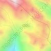
Carte topographique Mansuna

Cliquez sur la carte pour afficher l’altitude.

À propos de cette carte

Nom : Carte topographique Mansuna, altitude, relief.

Lieu : Mansuna, Ukhimath, Rudraprayag District, Uttarakhand, 246469, India (30.52807 79.10405 30.56807 79.14405)

Altitude moyenne : 1’653 m

Altitude minimum : 1’107 m

Altitude maximum : 2’494 m

Autres cartes topographiques

Cliquez sur une carte pour visualiser sa topographie, son altitude et son relief.
Chorabari Glacier

India > Uttarakhand > Ukhimath > Kedarnath

Altitude moyenne : 5’011 m

Lake Vasuki Tal

India > Uttarakhand > Ukhimath > Kedarnath

Altitude moyenne : 4’303 m

Kedarnath Wildlife Sanctuary

India > Uttarakhand > Ukhimath

Located in the Himalayan Highlands with an elevation ranging from 1,160 metres (3,810 ft) (near Phata) to the Chaukhamba peak at 7,068 m (23,189 ft), it was a notified reserve forest between 1916 and 1920. It was changed to a sanctuary on 21 January 1972, and has been designated a "Habitat/Species Management…

Altitude moyenne : 3’285 m

Lake Vasuki Tal

India > Uttarakhand > Ukhimath > Kedarnath

Altitude moyenne : 4’303 m

Équipez-vous pour votre prochaine aventure :

🧤Sous-vêtements techniques - Gestion thermique en effort
🧴Crèmes solaires haute protection - Protection UV renforcée
❄️Crampons de marche - Antidérapants pour les sentiers verglacés ou enneigés
🎒Sac d'hydratation VTT - Design ergonomique pour ne pas gêner les mouvements en descente
🧤Gants de montagne tactiles - Gardez vos mains au chaud tout en manipulant votre GPS ou smartphone

En tant que Partenaire Amazon, ce site perçoit une commission sur les achats éligibles sans surcoût pour vous.