
Carte topographique Yellowstone Caldera Supervolcano
Carte interactive
Cliquez sur la carte pour afficher l’altitude.
À propos de cette carte
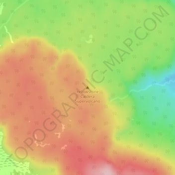
Nom : Carte topographique Yellowstone Caldera Supervolcano, altitude, relief.
Altitude moyenne : 2’530 m
Altitude minimum : 2’420 m
Altitude maximum : 2’616 m
Autres cartes topographiques
Cliquez sur une carte pour visualiser sa topographie, son altitude et son relief.
Wind River Range
United States of America > Wyoming
Wind River Range, Fremont County, Wyoming, United States of America
Altitude moyenne : 3’706 m
Cedar Rim
United States of America > Wyoming > Riverton
Cedar Rim, Sand Draw Road, Riverton, Fremont County, Wyoming, United States of America
Altitude moyenne : 2’131 m
Upton
United States of America > Wyoming > Upton
Upton, Weston County, Wyoming, United States of America
Altitude moyenne : 1’301 m
Red Butte
United States of America > Wyoming > Red Butte
Red Buttes Village, Red Butte, Natrona County, Wyoming, 82604, United States of America
Altitude moyenne : 1’605 m
Devils Tower
United States of America > Wyoming
Devils Tower, Crook County, Wyoming, 82714, United States of America
Altitude moyenne : 1’236 m
Shoshone Geyser
United States of America > Wyoming
Shoshone Geyser, Shoshone Lake, Teton County, Wyoming, United States of America
Altitude moyenne : 2’416 m
Opal
United States of America > Wyoming > Opal
Opal, Lincoln County, Wyoming, United States of America
Altitude moyenne : 2’048 m
Phelps Lake
United States of America > Wyoming > Teton Village
Phelps Lake, Aspen Ridge Trail, Teton Village, Teton County, Wyoming, 83025, United States of America
Altitude moyenne : 2’084 m