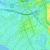
Carte topographique Pretty Hill
Cliquez sur la carte pour afficher l’altitude.
À propos de cette carte

Nom : Carte topographique Pretty Hill, altitude, relief.
Altitude moyenne : 135 m
Altitude minimum : 66 m
Altitude maximum : 204 m
Autres cartes topographiques
Cliquez sur une carte pour visualiser sa topographie, son altitude et son relief.







Lilydale-Warburton Rail Trail
Australia > Victoria > Melbourne > Woori Yallock
Altitude moyenne : 105 m





Gilbertsons Grassland Nature Conservation Reserve
Australia > Victoria > Melbourne
Altitude moyenne : 36 m




Fitzroy
Australia > Victoria > Melbourne
Fitzroy's topography is flat. It is laid out in grid plan and is characterised by a fairly tightly spaced rectangular grid of medium-sized streets, with many of its narrow streets and back lanes facilitating only one-way traffic. Its built form is a legacy of its early history when a mixture of land uses was…
Altitude moyenne : 35 m












Vermont South
Australia > Victoria > Melbourne
In 1966 the Metropolitan & Melbourne Board of Works (MMBW) put forth a plan to construct numerous "package" sewage treatment plants in the valleys of Dandenong Creek and its tributaries. The project aimed to provide adequate sewerage to the catchment before the Dandenong Valley Trunk sewer (DVT) could…
Altitude moyenne : 100 m