
Carte topographique Mianeh
Carte interactive
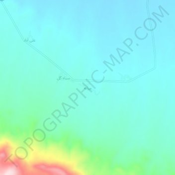
Cliquez sur la carte pour afficher l’altitude.
À propos de cette carte
Nom : Carte topographique Mianeh, altitude, relief.
Altitude moyenne : 1’536 m
Altitude minimum : 1’477 m
Altitude maximum : 1’819 m
Autres cartes topographiques
Cliquez sur une carte pour visualiser sa topographie, son altitude et son relief.
Golil
Iran > Kermanshah Province > Kermanshah County > دهستان عثمانوند
Golil, دهستان عثمانوند, بخش فیروزآباد, Kermanshah County, Kermanshah Province, Iran
Altitude moyenne : 1’428 m
Taveh Miv
Iran > Kermanshah Province > Kermanshah County > دهستان عثمانوند
Taveh Miv, دهستان عثمانوند, بخش فیروزآباد, Kermanshah County, Kermanshah Province, Iran
Altitude moyenne : 1’500 m