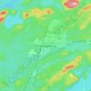
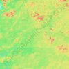
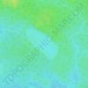
Carte topographique Lac Sakami
Cliquez sur la carte pour afficher l’altitude.
Lac Sakami
Lac Sakami is now a reservoir of the James Bay Project with a depth of 113 m (371 ft), an elevation of 186 m (610 ft) and an area of 738 km2 (285 sq mi). Prior to being used as a reservoir it had an area of 533 km2 (206 sq mi). The Cree called the lake Mesackamee.
À propos de cette carte

Nom : Carte topographique Lac Sakami, altitude, relief.
Lieu : Lac Sakami, Jamésie, Nord-du-Québec, Quebec, Canada (52.94560 -77.01987 53.49126 -76.34647)
Altitude moyenne : 202 m
Altitude minimum : 168 m
Altitude maximum : 363 m
Autres cartes topographiques
Cliquez sur une carte pour visualiser sa topographie, son altitude et son relief.

Chisasibi (partie Inuit)
Canada > Quebec > Jamésie > Chisasibi (Land) > Chisasibi
Altitude moyenne : 11 m
Lebel-sur-Quévillon
Canada > Quebec > Jamésie > Lebel-sur-Quévillon > Lebel-sur-Quévillon
Altitude moyenne : 285 m