
Carte topographique Sankranti
Carte interactive
Cliquez sur la carte pour afficher l’altitude.
À propos de cette carte
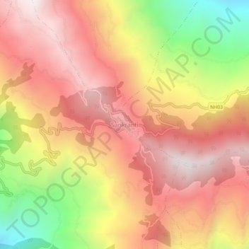
Nom : Carte topographique Sankranti, altitude, relief.
Lieu : Sankranti, Aathrai, Tehrathum, Koshi Province, Nepal (27.20039 87.63181 27.24039 87.67181)
Altitude moyenne : 1’734 m
Altitude minimum : 1’017 m
Altitude maximum : 2’195 m
Autres cartes topographiques
Cliquez sur une carte pour visualiser sa topographie, son altitude et son relief.
Aathrai
Nepal > Koshi Province > Tehrathum
Aathrai, Tehrathum, Koshi Province, Nepal
Altitude moyenne : 1’186 m
Loktantrik Chok
Nepal > Koshi Province > Tehrathum > Myanglung Bazar
Loktantrik Chok, Myanglung-02, Myanglung Bazar, Myanglung, Tehrathum, Koshi Province, Nepal
Altitude moyenne : 1’343 m