
Carte topographique Jagdschloss Letzlingen
Carte interactive
Cliquez sur la carte pour afficher l’altitude.
À propos de cette carte
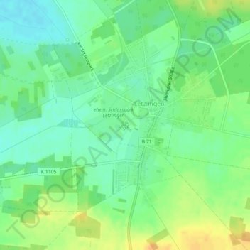
Nom : Carte topographique Jagdschloss Letzlingen, altitude, relief.
Altitude moyenne : 75 m
Altitude minimum : 62 m
Altitude maximum : 92 m
Autres cartes topographiques
Cliquez sur une carte pour visualiser sa topographie, son altitude et son relief.
Dannefeld
Deutschland > Sachsen-Anhalt > Gardelegen > Dannefeld
Dannefeld, Gardelegen, Altmarkkreis Salzwedel, Sachsen-Anhalt, Deutschland
Altitude moyenne : 60 m