Géolocaliser

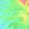
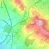
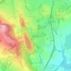
Carte topographique Stoke Pound

Cliquez sur la carte pour afficher l’altitude.

À propos de cette carte

Nom : Carte topographique Stoke Pound, altitude, relief.

Lieu : Stoke Pound, Bromsgrove, Worcestershire, England, B60 3AX, United Kingdom (52.28881 -2.07613 52.32881 -2.03613)

Altitude moyenne : 86 m

Altitude minimum : 55 m

Altitude maximum : 138 m

Autres cartes topographiques

Cliquez sur une carte pour visualiser sa topographie, son altitude et son relief.
Romsley CP

United Kingdom > England > Worcestershire > Bromsgrove

Altitude moyenne : 205 m

Finstall CP

United Kingdom > England > Worcestershire > Bromsgrove

Altitude moyenne : 110 m

Beoley CP

United Kingdom > England > Worcestershire > Bromsgrove > Holt End

Altitude moyenne : 134 m

Clent

United Kingdom > England > Worcestershire > Bromsgrove

Because of the hilly topography of the parish the village consists of several distinct hamlets. These are Upper Clent (Clatterbach and the area around the parish church of St. Leonard), Lower Clent, Holy Cross, Adams Hill and Walton Pool. The Civil Parish of Clent also included part of the village of West…

Altitude moyenne : 184 m
Romsley CP

United Kingdom > England > Worcestershire > Bromsgrove

Altitude moyenne : 205 m

Wythall CP

United Kingdom > England > Worcestershire > Bromsgrove

Altitude moyenne : 155 m

Wythall CP

United Kingdom > England > Worcestershire > Bromsgrove

Altitude moyenne : 155 m

Équipez-vous pour votre prochaine aventure :

🪑Siège de randonnée pliable - Le confort d'une pause assise sans le poids encombrant
🥫Plats lyophilisés - Repas légers et énergétiques pour l'autonomie totale
🔋Batteries solaires - Recharge d’appareils en autonomie
🧤Gants de montagne tactiles - Gardez vos mains au chaud tout en manipulant votre GPS ou smartphone
🐕Harnais de randonnée pour chien - Partagez vos aventures avec votre compagnon à quatre pattes

En tant que Partenaire Amazon, ce site perçoit une commission sur les achats éligibles sans surcoût pour vous.