Géolocaliser

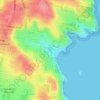
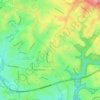
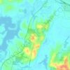
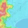
Carte topographique Tuglow

Cliquez sur la carte pour afficher l’altitude.

À propos de cette carte

Nom : Carte topographique Tuglow, altitude, relief.

Lieu : Tuglow, Gingkin, New South Wales, 2787, Australia (-33.96833 149.91444 -33.92833 149.95444)

Altitude moyenne : 1’118 m

Altitude minimum : 954 m

Altitude maximum : 1’254 m

Autres cartes topographiques

Cliquez sur une carte pour visualiser sa topographie, son altitude et son relief.
Sydney

Australia > New South Wales

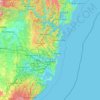
Sydney's topography is characterized by a diverse landscape that seamlessly blends coastal features with inland plateaus. The city is divided into two primary regions: the relatively flat Cumberland Plain to the south and west of Sydney Harbour, and the elevated Hornsby Plateau to the north. The Cumberland…

Altitude moyenne : 51 m
Orange

Australia > New South Wales

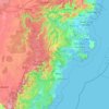
Orange is a city in the Central Tablelands region of New South Wales, Australia. It is 254 km (158 mi) west of the state capital, Sydney [206 km (128 mi) on a great circle], at an altitude of 862 metres (2,828 ft). Orange had an estimated urban population of 40,493 as of June 2018 making the city a significant…

Altitude moyenne : 852 m
Randwick

Australia > New South Wales > Sydney

Altitude moyenne : 44 m

Lismore

Australia > New South Wales

Altitude moyenne : 23 m

Newcastle

Australia > New South Wales > Newcastle

Altitude moyenne : 5 m

Delegate

Australia > New South Wales

Altitude moyenne : 841 m

Marrickville

Australia > New South Wales > Sydney

Altitude moyenne : 17 m

Wauchope

Australia > New South Wales

Altitude moyenne : 32 m

Port Macquarie

Australia > New South Wales

Altitude moyenne : 5 m

Illawarra

Australia > New South Wales

Altitude moyenne : 234 m

Glen Innes

Australia > New South Wales

Altitude moyenne : 1’083 m

Bundeena

Australia > New South Wales

Altitude moyenne : 20 m

Carrington

Australia > New South Wales > Newcastle

Altitude moyenne : 3 m

Cooma

Australia > New South Wales

Altitude moyenne : 869 m

Woombah

Australia > New South Wales

Altitude moyenne : 14 m

Moruya

Australia > New South Wales

Altitude moyenne : 37 m

Parramatta

Australia > New South Wales

Altitude moyenne : 22 m

Barrington Tops

Australia > New South Wales

Altitude moyenne : 1’107 m

Yass

Australia > New South Wales

Yass is located 280 km south-west of Sydney, on the Hume Highway. The Yass River, which is a tributary of the Murrumbidgee River, flows through the town. Yass is 59 km from Canberra; lying at an elevation of 505 m AMSL.

Altitude moyenne : 533 m

Carcoar

Australia > New South Wales

Altitude moyenne : 818 m

Georges River

Australia > New South Wales

Altitude moyenne : 120 m

Central Coast Council

Australia > New South Wales

Altitude moyenne : 103 m

Penrith

Australia > New South Wales > Sydney > Penrith

Penrith is a city in New South Wales, Australia, located in Greater Western Sydney, 55 kilometres (31 mi) west of the Sydney central business district on the banks of the Nepean River, on the outskirts of the Cumberland Plain. Its elevation is 32 metres (105 ft).

Altitude moyenne : 34 m
Engadine

Australia > New South Wales > Sydney

Altitude moyenne : 121 m

Rosehill

Australia > New South Wales > Sydney

Altitude moyenne : 9 m

Northern Beaches

Australia > New South Wales > Sydney

Altitude moyenne : 67 m

Isabella

Australia > New South Wales

Altitude moyenne : 1’070 m

Mulbring

Australia > New South Wales

Altitude moyenne : 96 m

Griffith

Australia > New South Wales

Altitude moyenne : 131 m

Wingham

Australia > New South Wales

Altitude moyenne : 47 m

Calderwood

Australia > New South Wales

Altitude moyenne : 100 m

Bowral

Australia > New South Wales

Altitude moyenne : 690 m

Terrigal

Australia > New South Wales

Altitude moyenne : 13 m

Moree

Australia > New South Wales

Altitude moyenne : 216 m

Mudgee

Australia > New South Wales

Altitude moyenne : 535 m

Coogee

Australia > New South Wales

Altitude moyenne : 35 m

Talbingo

Australia > New South Wales

Altitude moyenne : 740 m

Woodenbong

Australia > New South Wales

Altitude moyenne : 474 m

Luddenham

Australia > New South Wales

Altitude moyenne : 72 m

Wagga Wagga

Australia > New South Wales

Altitude moyenne : 183 m

Knockrow

Australia > New South Wales

Altitude moyenne : 54 m

Lawrence

Australia > New South Wales

Altitude moyenne : 25 m

Windradyne

Australia > New South Wales

Altitude moyenne : 702 m

Spring Ridge

Australia > New South Wales

Altitude moyenne : 344 m

Moruya Heads

Australia > New South Wales

Altitude moyenne : 9 m

Bondi State Forest

Australia > New South Wales

Altitude moyenne : 711 m

Goulburn

Australia > New South Wales

Owing to its elevation, Goulburn has an oceanic climate (Cfb) with warm summers and cool winters; with a high diurnal range. Its climate is variable much of the year, though generally dry with maximum temperatures ranging from 11.8 °C (53.2 °F) in July to 28.3 °C (82.9 °F) in January. Rainfall is…

Altitude moyenne : 666 m
Byron Bay

Australia > New South Wales

Byron Bay, located in northeastern New South Wales, Australia, is characterized by diverse topography shaped by its geological history. The town is part of the erosion caldera of the ancient Tweed Volcano, which erupted approximately 23 million years ago, resulting in the rich volcanic soils that define the…

Altitude moyenne : 7 m
Blackheath

Australia > New South Wales

Blackheath (postcode: 2785) is an Australian town located near the highest point of the Blue Mountains, between Katoomba and Mount Victoria in New South Wales. The town's altitude is about 1,065 metres (3,494 ft) AHD  and it is located about 120 kilometres (75 mi) west north-west of Sydney, 11 kilometres…

Altitude moyenne : 893 m
Islington

Australia > New South Wales > Newcastle

Altitude moyenne : 6 m

Baulkham Hills

Australia > New South Wales > Sydney

Altitude moyenne : 93 m

Rozelle

Australia > New South Wales > Sydney

Altitude moyenne : 16 m

Chatswood

Australia > New South Wales

Altitude moyenne : 81 m

Haberfield

Australia > New South Wales > Sydney

Altitude moyenne : 18 m

Gordon

Australia > New South Wales > Sydney

Altitude moyenne : 101 m

Wollongbar

Australia > New South Wales

Altitude moyenne : 134 m

Sydney

Australia > New South Wales > Sydney

Altitude moyenne : 23 m

Raymond Terrace

Australia > New South Wales

Altitude moyenne : 9 m

Charlestown

Australia > New South Wales

Altitude moyenne : 71 m

Castle Hill

Australia > New South Wales

Altitude moyenne : 123 m

Denistone

Australia > New South Wales > Sydney

Altitude moyenne : 60 m

Bondi Beach

Australia > New South Wales > Sydney

Altitude moyenne : 31 m

Gillieston Heights

Australia > New South Wales

Altitude moyenne : 12 m

Waterfall

Australia > New South Wales > Sydney

Altitude moyenne : 178 m

Gulgong

Australia > New South Wales

Altitude moyenne : 454 m

Coorabell

Australia > New South Wales

Altitude moyenne : 70 m

Diehard

Australia > New South Wales

Altitude moyenne : 816 m

Mandurama

Australia > New South Wales

Altitude moyenne : 742 m

Kanwal

Australia > New South Wales

Altitude moyenne : 23 m

Wakeley

Australia > New South Wales > Sydney

Altitude moyenne : 31 m

Grattai

Australia > New South Wales

Altitude moyenne : 635 m

Hampton

Australia > New South Wales

Altitude moyenne : 959 m

Shoalhaven Heads

Australia > New South Wales

Altitude moyenne : 5 m

Lake Munmorah

Australia > New South Wales

Altitude moyenne : 10 m

San Remo

Australia > New South Wales

Altitude moyenne : 16 m

Campbelltown

Australia > New South Wales

Altitude moyenne : 96 m

Northmead

Australia > New South Wales

Altitude moyenne : 52 m

Rutherford

Australia > New South Wales

Altitude moyenne : 23 m

Mittagong

Australia > New South Wales

Altitude moyenne : 672 m

Little Hartley

Australia > New South Wales

Altitude moyenne : 790 m

Leura

Australia > New South Wales

Leura's elevation of 985 metres (3,232 ft) AHD  leads to occasional snowfall in winter and a climate that reflects all four seasons distinctly.

Altitude moyenne : 880 m
Avoca Beach

Australia > New South Wales

Altitude moyenne : 23 m

Umina Beach

Australia > New South Wales

Altitude moyenne : 38 m

King Creek

Australia > New South Wales > Wauchope > King Creek

Altitude moyenne : 6 m

Équipez-vous pour votre prochaine aventure :

🚴Sacs d’hydratation - Hydratation en mouvement
🛶Sacs étanches - Protection du matériel contre l’eau
🔦Lampes frontales - Éclairage mains libres pour randonnée et bivouac
🍼Gourde inox isotherme - Conserve le café chaud ou l'eau fraîche pendant des heures
🔋Piles rechargeables - Économiques et écologiques pour vos appareils nomades

En tant que Partenaire Amazon, ce site perçoit une commission sur les achats éligibles sans surcoût pour vous.