
Merci de soutenir ce site ❤️
Faire un don
Faire un don
Équipez-vous pour votre prochaine aventure :
En tant que Partenaire Amazon, ce site perçoit une commission sur les achats éligibles sans surcoût pour vous.
Carte topographique Lohr-Lindig
Cliquez sur la carte pour afficher l’altitude.
Merci de soutenir ce site ❤️
Faire un don
Faire un don
Équipez-vous pour votre prochaine aventure :
En tant que Partenaire Amazon, ce site perçoit une commission sur les achats éligibles sans surcoût pour vous.
À propos de cette carte
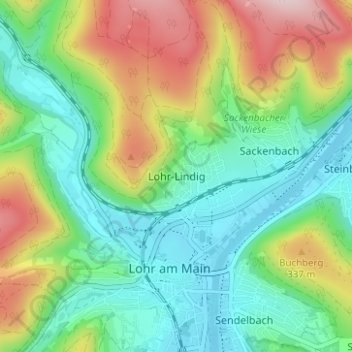
Nom : Carte topographique Lohr-Lindig, altitude, relief.
Altitude moyenne : 255 m
Altitude minimum : 149 m
Altitude maximum : 460 m
Merci de soutenir ce site ❤️
Faire un don
Faire un don
Équipez-vous pour votre prochaine aventure :
En tant que Partenaire Amazon, ce site perçoit une commission sur les achats éligibles sans surcoût pour vous.