
Carte topographique Ballymount
Carte interactive
Cliquez sur la carte pour afficher l’altitude.
À propos de cette carte
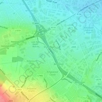
Nom : Carte topographique Ballymount, altitude, relief.
Altitude moyenne : 68 m
Altitude minimum : 44 m
Altitude maximum : 129 m
Autres cartes topographiques
Cliquez sur une carte pour visualiser sa topographie, son altitude et son relief.
Newlands Demesne
Newlands Demesne, Tallaght-Belgard ED, Dublin 24, South Dublin, County Dublin, Leinster, Ireland
Altitude moyenne : 88 m
Mountseskin
Mountseskin, Ballinascorney ED, Dublin 24, South Dublin, County Dublin, Leinster, Ireland
Altitude moyenne : 310 m