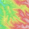
Carte topographique Ferguson Mountain
Cliquez sur la carte pour afficher l’altitude.
À propos de cette carte

Nom : Carte topographique Ferguson Mountain, altitude, relief.
Lieu : Ferguson Mountain, Klamath County, Oregon, United States (42.48121 -121.19199 42.48131 -121.19189)
Altitude moyenne : 1’507 m
Altitude minimum : 1’360 m
Altitude maximum : 1’739 m
Autres cartes topographiques
Cliquez sur une carte pour visualiser sa topographie, son altitude et son relief.

Willamette River
United States > Oregon > Polk County
The Willamette River drains a region of 11,478 square miles (29,730 km2), which is 12 percent of the total area of Oregon. Bounded by the Coast Range to the west and the Cascade Range to the east, the river basin is about 180 miles (290 km) long and 100 miles (160 km) wide. Elevations within the watershed…
Altitude moyenne : 72 m


Cascade Locks Marine Park
United States > Oregon > Hood River County > Cascade Locks
Altitude moyenne : 72 m
Archie Briggs Canyon Natural Area
United States > Oregon > Deschutes County > Bend
Altitude moyenne : 1’115 m
Elkton
United States > Oregon > Douglas County
According to the United States Census Bureau, the city has a total area of 0.26 square miles (0.67 km2), of which, 0.23 square miles (0.60 km2) is land and 0.03 square miles (0.08 km2) is water. The elevation is 141 feet (43 m).
Altitude moyenne : 95 m

Central Point
United States > Oregon > Jackson County
The city lies at an elevation of about 1,272 feet (388 m) along Oregon Highway 99 and Interstate 5 northwest of Medford. Jacksonville is to the south and Gold Hill to the northwest. The Central Oregon and Pacific Railroad passes through Central Point.
Altitude moyenne : 385 m

Wilsonville
United States > Oregon > Clackamas County
Wilsonville is located on the southern edge of the Portland metropolitan area sitting at an elevation of 154 feet (47 m) above sea level. Primarily in the southwestern part of Clackamas County, the northern section is in Washington County. It is located on the north side of the Willamette River around where…
Altitude moyenne : 60 m
Forest Park
United States > Oregon > Multnomah County > Portland
Solidified lava from Grande Ronde members of the Columbia River Basalt Group underlie Forest Park. About 16 million years ago during the Middle Miocene, the Columbia River ran through a lowland south of its modern channel. Eruptions from linear vents in eastern Oregon and Washington flowed down this channel…
Altitude moyenne : 91 m
Waldo Lake Wilderness
United States > Oregon > Lane County
Ninety-eight percent of the Waldo Lake Wilderness is covered by forest on moderate to steep terrain, which ranges in elevation from 2,800 to 7,144 feet (853 to 2,177 m).
Altitude moyenne : 1’528 m
Duck Lake Willamette River Greenway
United States > Oregon > Multnomah County > Scappoose
Altitude moyenne : 52 m


Shaniko
United States > Oregon > Wasco County > Shaniko
The city is at an elevation of 3,343 feet (1,019 m). On the high plateau on which Shaniko was built, the soil is thin and the vegetation sparse, consisting mainly of sagebrush, bunchgrass, and occasional junipers. Many peaks of the Cascade Range, including Hood, Jefferson, Adams, St. Helens and Rainier, are…
Altitude moyenne : 1’009 m

Peter Skene Ogden State Scenic Viewport
United States > Oregon > Jefferson County
Altitude moyenne : 839 m