
Carte topographique Penfield
Carte interactive
Cliquez sur la carte pour afficher l’altitude.
À propos de cette carte
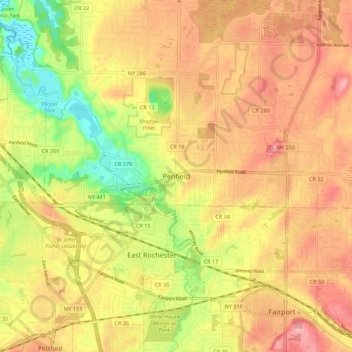
Nom : Carte topographique Penfield, altitude, relief.
Altitude moyenne : 137 m
Altitude minimum : 72 m
Altitude maximum : 182 m
It is believed by some that nearly two million years ago, Penfield's topography was formed by melting glaciers. The same forces that created the Finger Lakes helped develop interesting terrain in and around Ellison Park. These glacial ice melt carvings left fertile lands which today is used in farming (and from the late 20th century to the present, housing developments). The soil is rich for farming certain types of apples, cherries, plums, peaches, and pears.