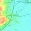
Carte topographique Easby
Cliquez sur la carte pour afficher l’altitude.
À propos de cette carte

Nom : Carte topographique Easby, altitude, relief.
Lieu : Easby, North Yorkshire, England, United Kingdom (54.46423 -1.14239 54.48525 -1.08441)
Altitude moyenne : 132 m
Altitude minimum : 84 m
Altitude maximum : 322 m
Autres cartes topographiques
Cliquez sur une carte pour visualiser sa topographie, son altitude et son relief.



Harrogate
United Kingdom > England > North Yorkshire
Harrogate is situated on the edge of the Yorkshire Dales, with the Vale of York to the east and the upland Yorkshire Dales to the west and north-west. It has a dry and mild climate, typical of places in the rain shadow of the Pennines. It is on the A59 from Skipton to York. At an altitude of between 100 and…
Altitude moyenne : 106 m








Bolton Castle
United Kingdom > England > North Yorkshire > Redmire > Castle Bolton
Altitude moyenne : 250 m



Horsehouse
United Kingdom > England > North Yorkshire
Horsehouse is a village in Coverdale in the Yorkshire Dales, North Yorkshire, England. It is listed as a hamlet in many texts, but the presence of the church makes it a village. The River Cover runs near the village, and it lies some 6 miles (9.7 km) and 8.5 miles (13.7 km) south-west of Middleham and Leyburn…
Altitude moyenne : 354 m













Thimbleby & Osmotherly Show field
United Kingdom > England > North Yorkshire > Thimbleby
Altitude moyenne : 152 m






Killinghall
United Kingdom > England > North Yorkshire > Harrogate > Killinghall
Altitude moyenne : 86 m