
Carte topographique Lake Highlands
Carte interactive
Cliquez sur la carte pour afficher l’altitude.
À propos de cette carte
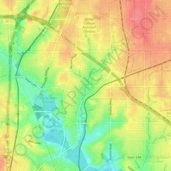
Nom : Carte topographique Lake Highlands, altitude, relief.
Altitude moyenne : 175 m
Altitude minimum : 141 m
Altitude maximum : 206 m
The neighborhood differs from much of Dallas and the surrounding area, which is fairly flat. Lake Highlands has hills and valleys, with street elevations that can vary by 50 feet, which offer scenic views of downtown Dallas.