
Carte topographique Lake of the Woods
Carte interactive
Cliquez sur la carte pour afficher l’altitude.
À propos de cette carte
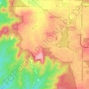
Nom : Carte topographique Lake of the Woods, altitude, relief.
Lieu : Lake of the Woods, Navajo County, Arizona, United States (34.12504 -110.01818 34.17314 -109.97206)
Altitude moyenne : 2’037 m
Altitude minimum : 1’946 m
Altitude maximum : 2’095 m