
Carte topographique Cairo
Carte interactive
Cliquez sur la carte pour afficher l’altitude.
À propos de cette carte
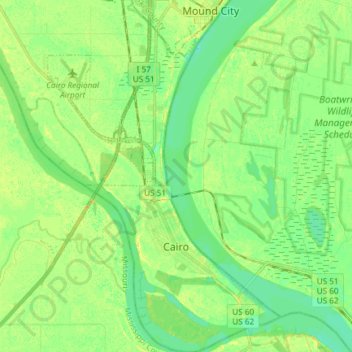
Nom : Carte topographique Cairo, altitude, relief.
Lieu : Cairo, Alexander County, Illinois, 62914, United States (36.97030 -89.23146 37.08887 -89.13292)
Altitude moyenne : 95 m
Altitude minimum : 85 m
Altitude maximum : 107 m
Cairo (/ˈkɛəroʊ/ KAIR-oh, sometimes /ˈkeɪroʊ/ KAY-roh) is the southernmost city in Illinois and the county seat of Alexander County. A river city, Cairo has the lowest elevation of any location in Illinois and is the only Illinois city to be surrounded by levees. It is in the river-crossed area of Southern Illinois known as "Little Egypt", for which the city is named, after Egypt's capital on the Nile. The city is coterminous with Cairo Precinct.
Autres cartes topographiques
Cliquez sur une carte pour visualiser sa topographie, son altitude et son relief.
Cairo
United States > Illinois > Alexander County > Cairo > Cairo
Cairo, Alexander County, Illinois, 62914, United States
Altitude moyenne : 95 m
Dogtooth Bend Mounds
United States > Illinois > Alexander County
Dogtooth Bend Mounds, Alexander County, Illinois, 62962, United States
Altitude moyenne : 98 m
McClure
United States > Illinois > Alexander County
McClure, Alexander County, Illinois, United States
Altitude moyenne : 103 m
Big Cypress
United States > Illinois > Alexander County
Big Cypress, Alexander County, Illinois, 62969, United States
Altitude moyenne : 101 m
Thebes
United States > Illinois > Alexander County
Thebes, Alexander County, Illinois, 62990, United States
Altitude moyenne : 119 m