
Carte topographique دهستان لای سیاه
Carte interactive
Cliquez sur la carte pour afficher l’altitude.
À propos de cette carte
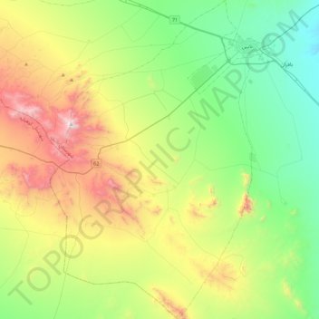
Nom : Carte topographique دهستان لای سیاه, altitude, relief.
Altitude moyenne : 1’910 m
Altitude minimum : 1’404 m
Altitude maximum : 2’936 m
Autres cartes topographiques
Cliquez sur une carte pour visualiser sa topographie, son altitude et son relief.
زندوان
Iran > Isfahan Province > Nain County > دهستان بافران > زندوان
زندوان, دهستان بافران, بخش مرکزی, Nain County, Isfahan Province, Iran
Altitude moyenne : 1’543 m