
Carte topographique Newmarket
Carte interactive
Cliquez sur la carte pour afficher l’altitude.
À propos de cette carte
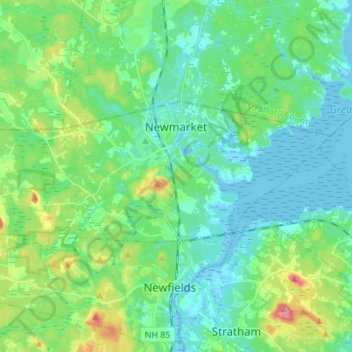
Nom : Carte topographique Newmarket, altitude, relief.
Altitude moyenne : 21 m
Altitude minimum : -8 m
Altitude maximum : 85 m
According to the United States Census Bureau, the town has a total area of 14.2 square miles (36.7 km2), of which 12.6 square miles (32.6 km2) are land and 1.6 square miles (4.1 km2) are water, comprising 11.24% of the town. Situated beside Great Bay, Newmarket is drained by the Lamprey River and its tributary, the Piscassic River. The town's highest point is the summit of Bald Hill, at 281 feet (86 m) above sea level, near the town's southwest corner. Great Hill, with an elevation of 228 feet (69 m), rises just south of the town center.