
Carte topographique Birgunj
Carte interactive
Cliquez sur la carte pour afficher l’altitude.
Birgunj
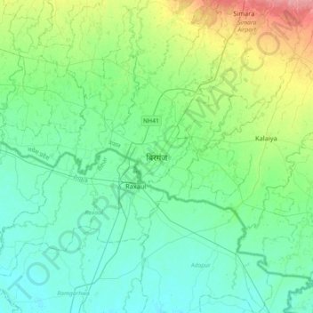
Birgunj is located in the Terai plain which is the northern part of the Indo-Gangetic plain. Birgunj metropolitan city has an elongated shape. The variation in altitude is in the range of 78 m to 95 m when moving from south to north of Birgunj. Although the range of altitude variation is small, but there is a high micro-topographical variation. The city lies about 90 m above sea level. Quaternary sediments are mainly found in the area. Soil is very fertile that consists the mixture of clay, silt and sand.
À propos de cette carte
Nom : Carte topographique Birgunj, altitude, relief.
Lieu : Birgunj, Parsa, Madhesh Province, 44300, Nepal (26.85352 84.71638 27.17352 85.03638)
Altitude moyenne : 88 m
Altitude minimum : 69 m
Altitude maximum : 152 m