
Carte topographique Wormingford
Carte interactive
Cliquez sur la carte pour afficher l’altitude.
À propos de cette carte
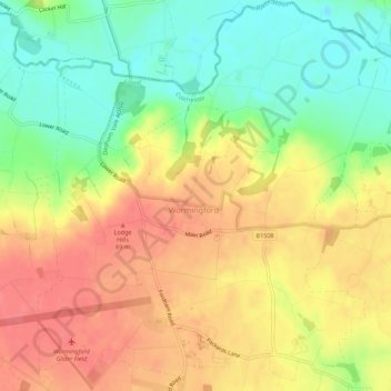
Nom : Carte topographique Wormingford, altitude, relief.
Altitude moyenne : 44 m
Altitude minimum : 10 m
Altitude maximum : 73 m
Autres cartes topographiques
Cliquez sur une carte pour visualiser sa topographie, son altitude et son relief.
Hilly Fields Local Nature Reserve
United Kingdom > England > Essex > Colchester
Hilly Fields Local Nature Reserve, Lexden, Colchester, Essex, East of England, England, United Kingdom
Altitude moyenne : 27 m
Fordham
United Kingdom > England > Essex > Colchester > Fordham
Fordham, Colchester, Essex, East of England, England, CO6 3NR, United Kingdom
Altitude moyenne : 51 m
Inworth
United Kingdom > England > Essex > Colchester > Inworth
Inworth, Colchester, Essex, East of England, England, CO5 9SP, United Kingdom
Altitude moyenne : 46 m