Géolocaliser

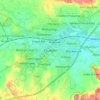
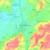
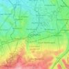
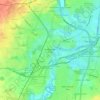
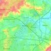
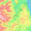
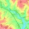
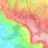
Carte topographique Stockton-on-Tees

Cliquez sur la carte pour afficher l’altitude.

À propos de cette carte

Nom : Carte topographique Stockton-on-Tees, altitude, relief.

Lieu : Stockton-on-Tees, Tees Valley, England, United Kingdom (54.46414 -1.45263 54.64524 -1.15354)

Altitude moyenne : 40 m

Altitude minimum : -3 m

Altitude maximum : 112 m

Autres cartes topographiques

Cliquez sur une carte pour visualiser sa topographie, son altitude et son relief.
London

United Kingdom > England > London

Altitude moyenne : 42 m

Erith

United Kingdom > England

Altitude moyenne : 17 m

Leeds

United Kingdom > England

Lying in the eastern foothills of the Pennines, there is a significant variation in elevation within the city's built-up area. The district ranges from 1,115 feet (340 m) in the far west on the slopes of Ilkley Moor to about 33 feet (10 m) where the rivers Aire and Wharfe cross the eastern boundary. Land rises…

Altitude moyenne : 94 m

Burwash Common

United Kingdom > England > East Sussex > Rother

Altitude moyenne : 98 m

Royston

United Kingdom > England

Royston lies on the Barnsley Canal, and on the intersection of the B6132 and B6428 roads, due north of Monk Bretton at an elevation of around 246 feet (75 m) above sea level. The Trans Pennine Trail runs through Royston along the canal bank. The parish is part of the diocese of Leeds.

Altitude moyenne : 74 m

Streatham

United Kingdom > England

Altitude moyenne : 37 m

York

United Kingdom > England > York

Altitude moyenne : 21 m

Salford

United Kingdom > England

At 53°28′59″N 2°17′35″W / 53.48306°N 2.29306°W / 53.48306; -2.29306 (53.483°, −2.2931°), and 205 miles (330 km) northwest of central London, Salford stands about 177 feet (54 m) above sea level, on relatively flat ground to the west of a meander of the River Irwell – the city's main…

Altitude moyenne : 106 m

Redmire

United Kingdom > England > North Yorkshire

Altitude moyenne : 223 m

Taunton

United Kingdom > England > Somerset

Altitude moyenne : 39 m

Leicester

United Kingdom > England > City of Leicester

Altitude moyenne : 109 m

Bolton

United Kingdom > England > Bolton

Altitude moyenne : 135 m

Newmarket

United Kingdom > England > Newmarket

Altitude moyenne : 51 m

Cirencester

United Kingdom > England > Cirencester

Altitude moyenne : 130 m

Derby

United Kingdom > England > Derbyshire

Altitude moyenne : 97 m

Ebbsfleet

United Kingdom > England > Kent > Thanet

Altitude moyenne : 4 m

Outlane

United Kingdom > England > Kirklees

Altitude moyenne : 241 m

Chesil Beach

United Kingdom > England > Dorset > Chickerell > Wyke Regis

Altitude moyenne : 13 m

Brownhills

United Kingdom > England

Altitude moyenne : 140 m

Carshalton

United Kingdom > England

Altitude moyenne : 62 m

Endcliffe Park

United Kingdom > England > Sheffield

Altitude moyenne : 161 m

Wimbledon

United Kingdom > England > Greater London

Altitude moyenne : 26 m

Scafell Pike

United Kingdom > England > Cumberland

Scafell Pike (/ˈskɔːfɛl paɪk/) is the highest and the most prominent mountain in England, at an elevation of 978 metres (3,209 ft) above sea level. It is located in the Lake District National Park, in Cumbria, and is part of the Southern Fells and the Scafell massif.

Altitude moyenne : 679 m
Harpenden

United Kingdom > England > Harpenden

Altitude moyenne : 120 m

Dartmouth

United Kingdom > England > South Hams > Dartmouth

Altitude moyenne : 77 m

Beverley

United Kingdom > England > Beverley

Altitude moyenne : 19 m

Towcester

United Kingdom > England > Towcester

St. Lawrence's C of E Church, stands in the middle of the town. It has a 12th-century Norman transitional ground plan and foundation, probably laid over a Saxon 10th century stone building. Its ecclesiastical heritage may well relate back to Roman times as St Lawrence was patron saint of the Roman legions. The…

Altitude moyenne : 117 m
Slough

United Kingdom > England > Berkshire

Altitude moyenne : 34 m

Reading

United Kingdom > England > Reading

Mary Russell Mitford lived in Reading for a number of years and then spent the rest of her life just outside the town at Three Mile Cross and Swallowfield. The fictional Belford Regis of her eponymous novel, first published in 1835, is largely based on Reading. Described with topographical accuracy, it is…

Altitude moyenne : 56 m
Stoke-on-Trent

United Kingdom > England > Stoke-on-Trent > Stoke-on-Trent

In 1919, the borough proposed to expand further and annex the neighbouring borough of Newcastle-under-Lyme and the Wolstanton United Urban District, both to the west of Stoke. This never took place, due to strong objections from Newcastle Corporation. A further attempt was made in 1930, with the promotion of…

Altitude moyenne : 160 m
Sharperton

United Kingdom > England > Northumberland

Altitude moyenne : 165 m

Triscombe

United Kingdom > England > Somerset > West Bagborough

Altitude moyenne : 216 m

Kensington

United Kingdom > England

Altitude moyenne : 19 m

Birkenhead

United Kingdom > England

Altitude moyenne : 24 m

Guisborough

United Kingdom > England > Guisborough

Altitude moyenne : 157 m

Shaftesbury

United Kingdom > England > Shaftesbury

Altitude moyenne : 135 m

Hebden Bridge

United Kingdom > England > Calderdale

Altitude moyenne : 277 m

Top of Hebers

United Kingdom > England > Middleton

Altitude moyenne : 117 m

Blunsdon St Andrew

United Kingdom > England > Swindon

Altitude moyenne : 104 m

Bromley Green

United Kingdom > England > Kent > Ashford > Orlestone

Altitude moyenne : 44 m

Stainland

United Kingdom > England > Calderdale

Altitude moyenne : 193 m

Caldy

United Kingdom > England

Altitude moyenne : 23 m

Great Harwood

United Kingdom > England > Lancashire > Hyndburn

Altitude moyenne : 130 m

Kinder Scout

United Kingdom > England > Derbyshire > High Peak

To the north across the Snake Pass lie the high moors of Bleaklow and Black Hill, which are of similar elevation.

Altitude moyenne : 555 m

Tyne and Wear

United Kingdom > England

Altitude moyenne : 144 m

Wickford

United Kingdom > England > Essex > Basildon

Altitude moyenne : 27 m

Hyde

United Kingdom > England > Tameside

Altitude moyenne : 138 m

Steyning

United Kingdom > England > Steyning

Altitude moyenne : 36 m

Thirsk

United Kingdom > England > Thirsk

Altitude moyenne : 45 m

Burwell

United Kingdom > England > Burwell

Altitude moyenne : 12 m

Marple

United Kingdom > England > Stockport

Altitude moyenne : 145 m

Durham

United Kingdom > England > County Durham

Altitude moyenne : 119 m

Fernworthy Reservoir

United Kingdom > England > Devon > West Devon

Altitude moyenne : 381 m

Thornton

United Kingdom > England > Lancashire > Borough of Wyre

Altitude moyenne : 7 m

Fountainhead

United Kingdom > England > Calderdale

Altitude moyenne : 245 m

Leeming Bar

United Kingdom > England > North Yorkshire

Altitude moyenne : 38 m

Birdwell

United Kingdom > England > Barnsley

Altitude moyenne : 121 m

Stretford

United Kingdom > England > Trafford

Altitude moyenne : 27 m

Blunsdon Hill

United Kingdom > England > Swindon > Broad Blunsdon

Altitude moyenne : 120 m

Pendennis Point

United Kingdom > England > Cornwall > Falmouth

Altitude moyenne : 2 m

Stainburn

United Kingdom > England > Cumberland > Workington

Altitude moyenne : 49 m

Lastingham

United Kingdom > England > North Yorkshire

Altitude moyenne : 142 m

Haddenham

United Kingdom > England > Buckinghamshire

Altitude moyenne : 77 m

Cheadle

United Kingdom > England > Stockport

Altitude moyenne : 59 m

Yeovilton

United Kingdom > England > Somerset

Altitude moyenne : 20 m

Bodden

United Kingdom > England > Somerset > Doulting

Altitude moyenne : 212 m

Bamford Edge

United Kingdom > England > Derbyshire > High Peak > Bamford

Altitude moyenne : 289 m

Moor End Green

United Kingdom > England > Birmingham > Erdington

Altitude moyenne : 108 m

Broad Town

United Kingdom > England > Wiltshire

Altitude moyenne : 155 m
Cheadle Hulme

United Kingdom > England

Altitude moyenne : 72 m
Southwell

United Kingdom > England > Dorset
Altitude moyenne : 23 m

Norwich

United Kingdom > England > Norfolk > Norwich

Altitude moyenne : 29 m

Stafford

United Kingdom > England > Staffordshire > Stafford > Stafford

Altitude moyenne : 97 m

Balsham

United Kingdom > England > Cambridgeshire > Balsham

Altitude moyenne : 97 m

Airedale

United Kingdom > England > East Riding of Yorkshire

Airedale, in conjunction with the Ribble Valley, provides low-altitude passes from Yorkshire to Lancashire through the Aire Gap. It is therefore an important transport route and was a strategically important area historically.

Altitude moyenne : 60 m
Bradford

United Kingdom > England

Bradford is located at 53°45′00″N 01°50′00″W / 53.75000°N 1.83333°W / 53.75000; -1.83333 (53.7500, -1.8333)1. Topographically, it is located in the eastern moorland region of the South Pennines.

Altitude moyenne : 167 m
Raithby

United Kingdom > England > Lincolnshire > East Lindsey

Altitude moyenne : 54 m

Belvoir

United Kingdom > England > Leicestershire > Melton

Altitude moyenne : 79 m

Équipez-vous pour votre prochaine aventure :

🔋Batteries solaires - Recharge d’appareils en autonomie
📱Supports téléphone vélo - Fixation sécurisée pour navigation GPS
🧴Crèmes solaires haute protection - Protection UV renforcée
🛡️Casque de VTT - Protection indispensable avec visière pour les passages en forêt
👖Pantalons de randonnée - Résistants et respirants

En tant que Partenaire Amazon, ce site perçoit une commission sur les achats éligibles sans surcoût pour vous.