
Carte topographique Mountgorry
Carte interactive
Cliquez sur la carte pour afficher l’altitude.
À propos de cette carte
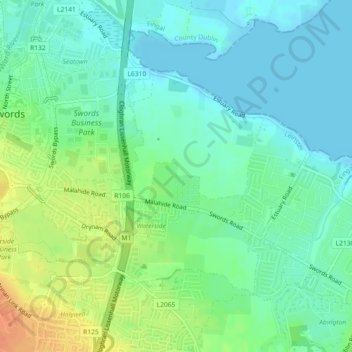
Nom : Carte topographique Mountgorry, altitude, relief.
Altitude moyenne : 14 m
Altitude minimum : -2 m
Altitude maximum : 41 m
Autres cartes topographiques
Cliquez sur une carte pour visualiser sa topographie, son altitude et son relief.
Collinstown
Collinstown, Airport ED, Swords, Fingal, County Dublin, Leinster, Ireland
Altitude moyenne : 62 m