
Carte topographique Sebastopol
Carte interactive
Cliquez sur la carte pour afficher l’altitude.
À propos de cette carte
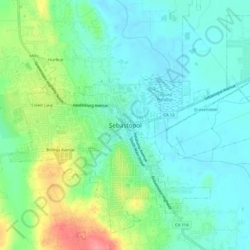
Nom : Carte topographique Sebastopol, altitude, relief.
Altitude moyenne : 41 m
Altitude minimum : 14 m
Altitude maximum : 108 m
Sebastopol's elevation is 65 to 250 feet (20 to 76 meters) above sea level. Its downtown is at the intersection of State Route 12 and State Route 116 (Gravenstein Highway), approximately 9 mi (14 km) west of U.S. Route 101.