
Carte topographique Lake Waitawa
Carte interactive
Cliquez sur la carte pour afficher l’altitude.
À propos de cette carte
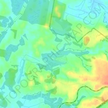
Nom : Carte topographique Lake Waitawa, altitude, relief.
Altitude moyenne : 24 m
Altitude minimum : 7 m
Altitude maximum : 57 m
Autres cartes topographiques
Cliquez sur une carte pour visualiser sa topographie, son altitude et son relief.
Ngatotara Lagoon
New Zealand > Wellington > Otaki
Ngatotara Lagoon, Taylors Road, Otaki, Kapiti Coast District, Wellington, 5512, New Zealand
Altitude moyenne : 17 m
Lake Kopureherehere
New Zealand > Wellington > Otaki
Lake Kopureherehere, Forest Lakes Road, Otaki, Kapiti Coast District, Wellington, 5512, New Zealand
Altitude moyenne : 22 m