

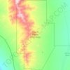
Carte topographique Mount Nutt
Cliquez sur la carte pour afficher l’altitude.
À propos de cette carte

Nom : Carte topographique Mount Nutt, altitude, relief.
Lieu : Mount Nutt, Mohave County, Arizona, United States (35.08773 -114.35362 35.08783 -114.35352)
Altitude moyenne : 1’242 m
Altitude minimum : 887 m
Altitude maximum : 1’581 m
Autres cartes topographiques
Cliquez sur une carte pour visualiser sa topographie, son altitude et son relief.

Kingman
United States > Arizona > Mohave County > Kingman
Lt. Edward Fitzgerald Beale, a U.S. Navy officer in the service of the U.S. Army Corps of Topographical Engineers, was ordered by the U.S. War Department to build a federal wagon road across the 35th Parallel. His secondary orders were to test the feasibility of the use of camels as pack animals in the…
Altitude moyenne : 1’131 m




Kingman
United States > Arizona > Mohave County
Lt. Edward Fitzgerald Beale, a U.S. Navy officer in the service of the Army Corps of Topographical Engineers, was ordered by the U.S. War Department to build a federal wagon road across the 35th parallel. His secondary orders were to test the feasibility of the use of camels as pack animals in the Southwestern…
Altitude moyenne : 1’131 m

Fort Mojave Indian Tribe
United States > Arizona > Mohave County > Mohave Valley
Altitude moyenne : 362 m
