
Carte topographique Kohlstatt
Carte interactive
Cliquez sur la carte pour afficher l’altitude.
À propos de cette carte
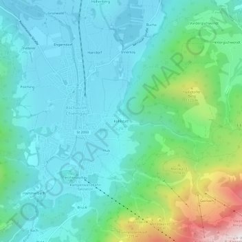
Nom : Carte topographique Kohlstatt, altitude, relief.
Altitude moyenne : 793 m
Altitude minimum : 584 m
Altitude maximum : 1’572 m
Autres cartes topographiques
Cliquez sur une carte pour visualiser sa topographie, son altitude et son relief.
Innerwald
Deutschland > Bayern > Landkreis Rosenheim > Aschau im Chiemgau
Innerwald, Aschau im Chiemgau, Landkreis Rosenheim, Bayern, Deutschland
Altitude moyenne : 1’034 m
Hohenaschau
Deutschland > Bayern > Landkreis Rosenheim > Aschau im Chiemgau
Hohenaschau, Aschau im Chiemgau, Landkreis Rosenheim, Bayern, 83229, Deutschland
Altitude moyenne : 863 m